On October 23rd, NCTC hosted a workshop where more than 25 community members convened to discuss potential design concepts for the Zion Street / Sacramento Street Corridor. After the first workshop in March, the project team developed several design alternatives for Zion Street, Sacramento Street, intersection improvements and improving school access based on community feedback and existing transportation conditions. At the second workshop, the concepts were presented, followed by small group conversations where community members discussed which designs they would like to see implemented.
The Zion Street and Sacramento Street design concepts identified by the community for further development are discussed below. Additionally, intersection improvements, traffic calming, and design concepts for improving school access for Reward Street, Doane Road, and Hoover Lane are also described. To download materials presented at the workshop, click "October 23 Presentation" and "Design Concepts Handout".
Tell us what you think about the proposed concepts! The concepts presented are still drafts - your feedback will be used to develop the final design included in the Zion-Sacramento Pedestrian and Bicycle Mobility Plan.
What We Heard
Zion Street
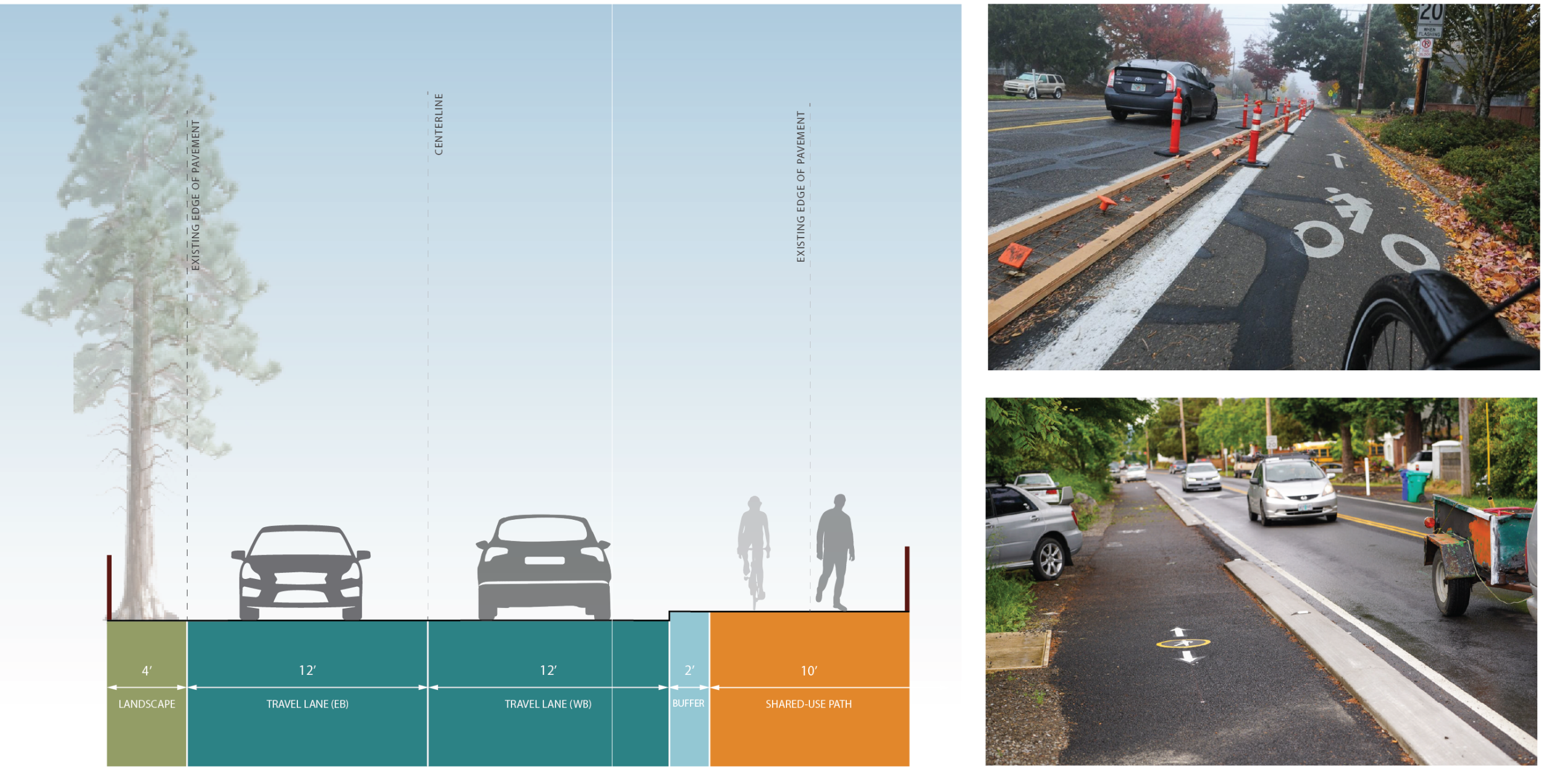
Zion Street: Separated Bikeways (Retain Parking)
At the workshop, most groups wanted to see separated bicycle lanes on Zion Street. Community priorities included:
- Separating bicyclists from vehicle traffic
- One-way bike lanes on either side of the street rather than a two-way bike path
- Providing designated pedestrian and bicycle facilities rather than having them share a path
- Retaining parking where possible
The image below highlights the tradeoffs discussed during the workshop.
Sacramento Street
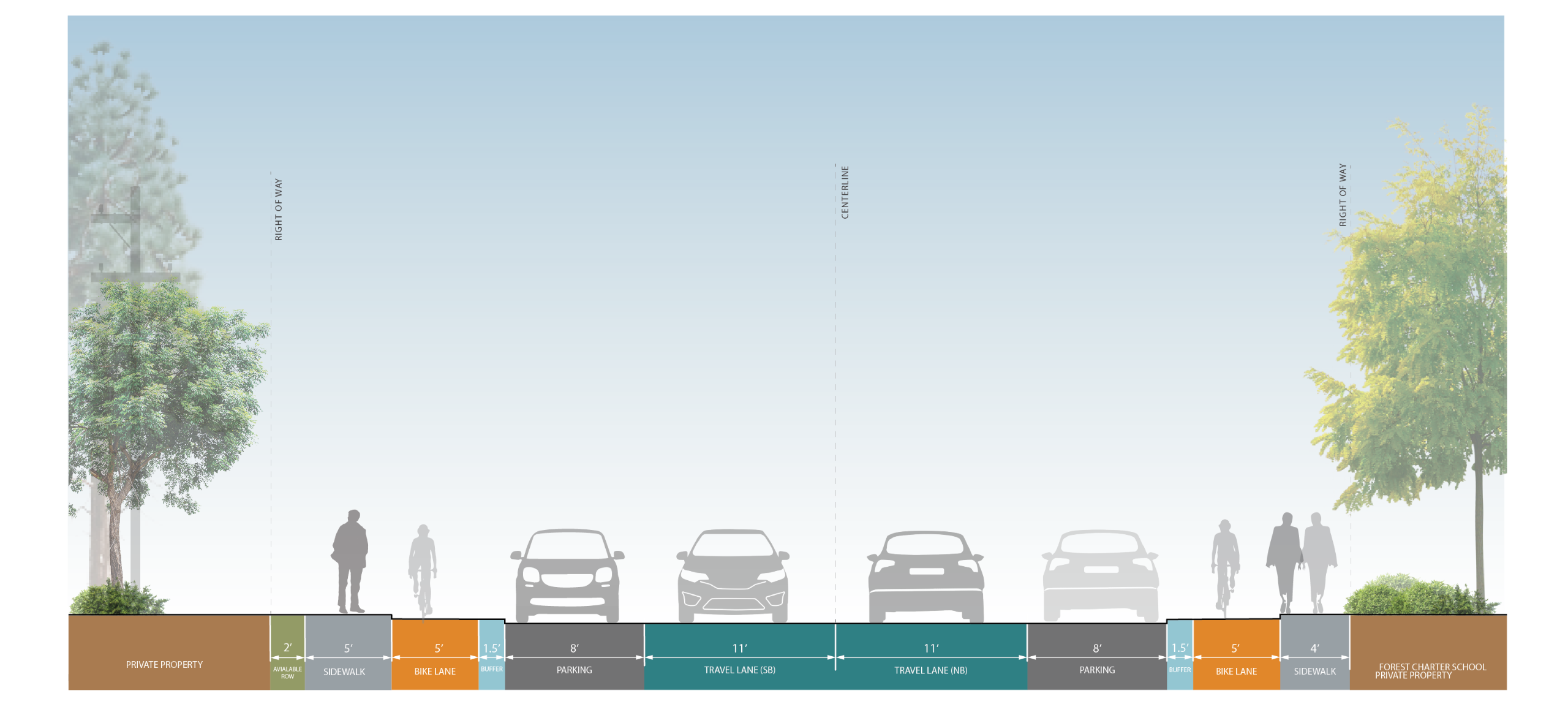
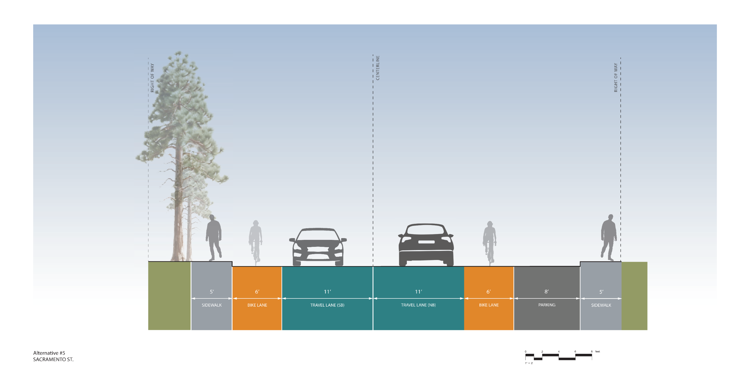
Sacramento Street: Bike Lanes
Workshop attendees preferred bike lanes on Sacramento Street. Community priorities included:
- One-way bike lanes on either side of the street rather than a two-way bike path
- Connectivity to Zion Street bike lanes that minimized the need for bicyclists to cross the street
The cross section below highlights the tradeoffs discussed at the workshop.
Traffic Calming
Traffic Calming
Community members supported the following improvements to slow driver speeds and improve pedestrian safety:
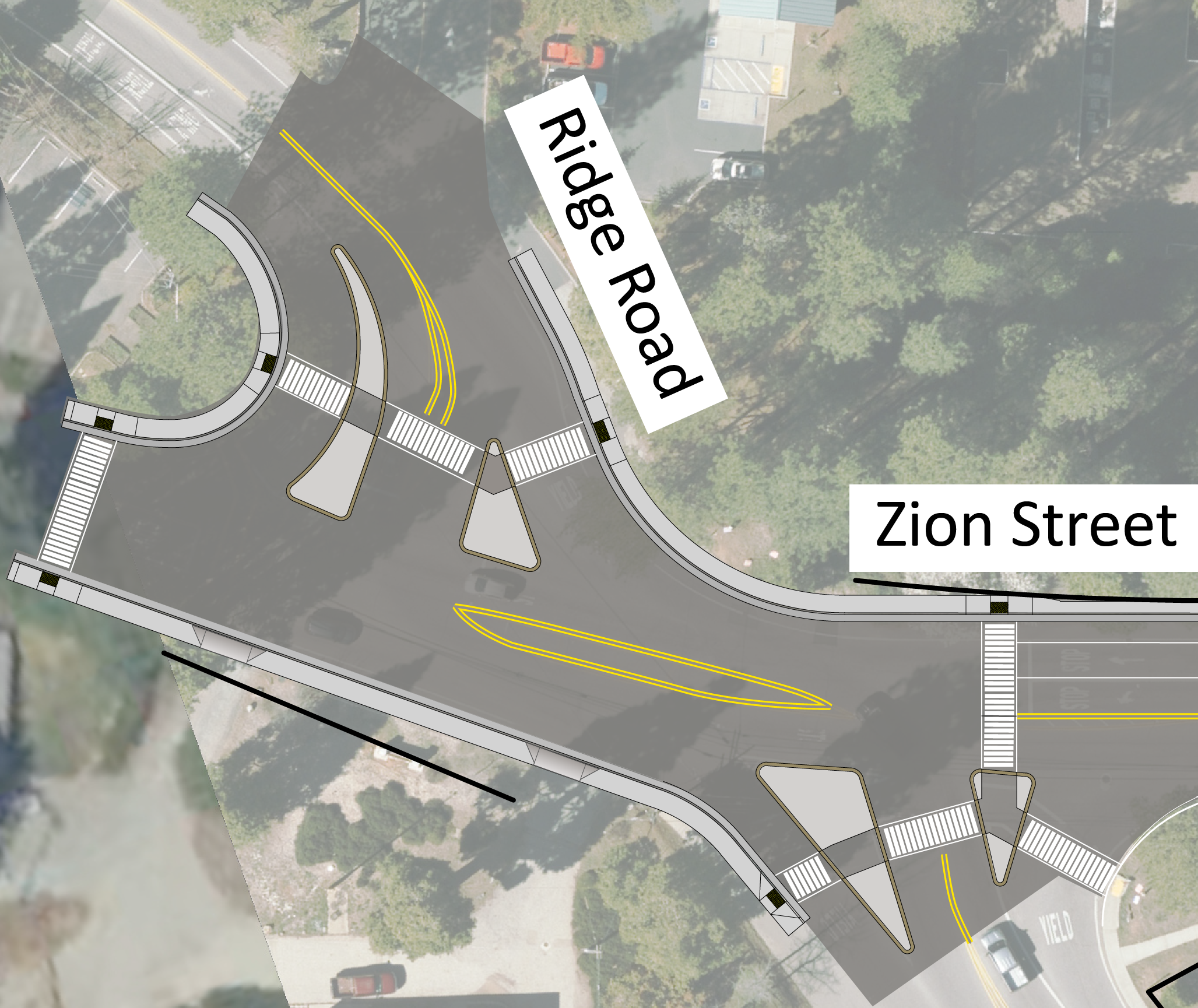
- Zion Street / Ridge Road intersection improvements, including raised pedestrian median islands at crosswalks
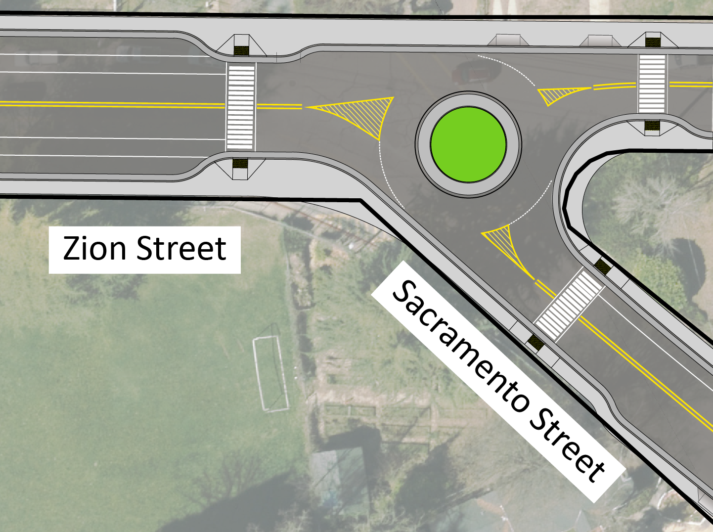
- A traffic circle at the Zion Street / Sacramento Street intersection
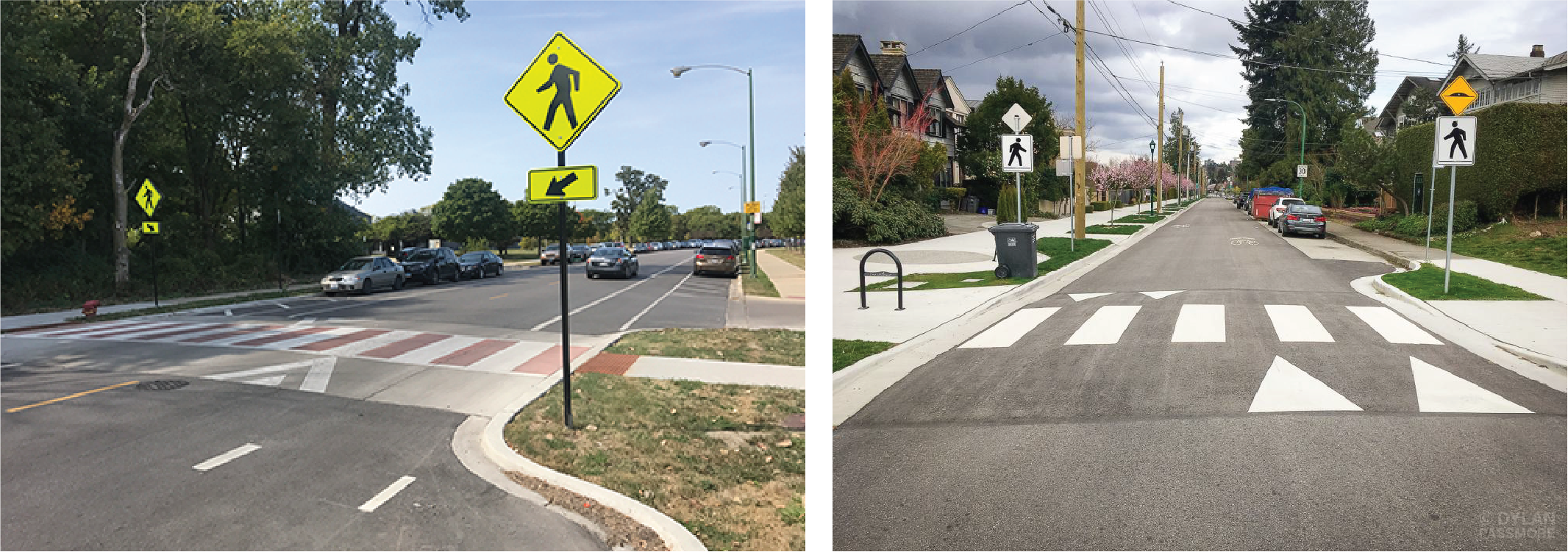
- Raised crosswalks throughout the corridor.
See the images below to learn about these proposed improvements.
Zion Street and Ridge Road Intersection
Sacramento Street and Zion Street Intersection
Raised Crosswalks
School Access
School Access Plan
The map below shows a potential plan for improving access to Seven Hills Middle School and Deer Creek Elementary School. The plan focuses on safe access for pedestrians and bicyclists. For more information about components the plan, scroll to see concepts for Reward Street and Doane Street.
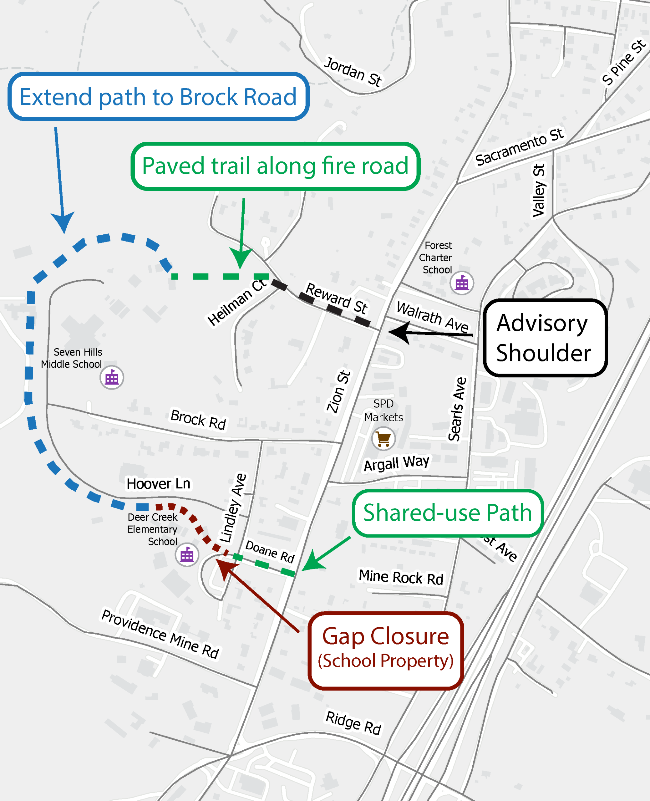
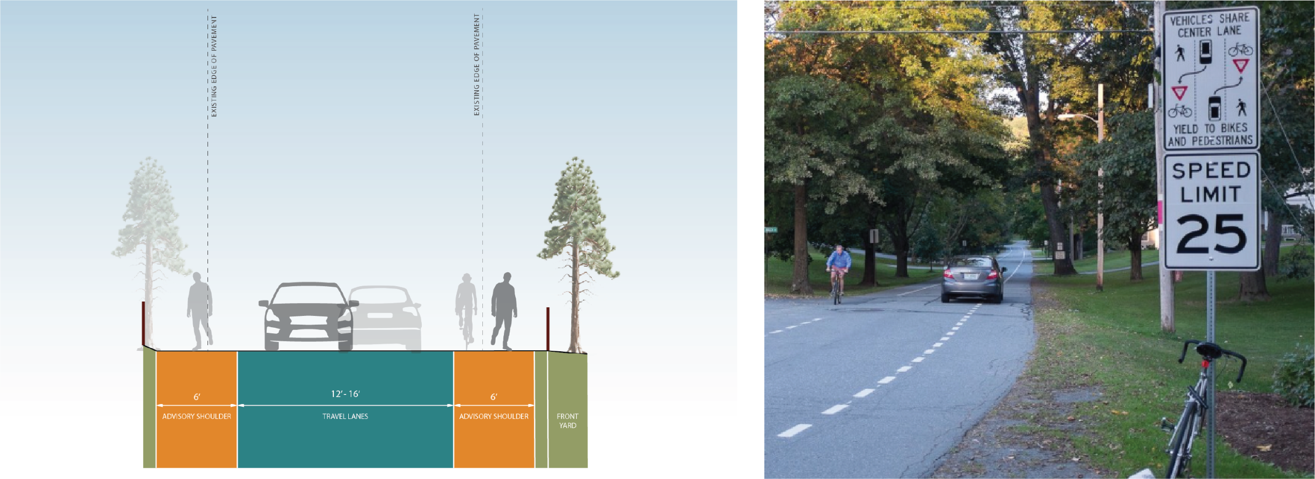
Reward Street
Advisory shoulders with minor widening are proposed on Reward Street. Dashed pavement markings create a space for pedestrians and bicyclists to use. Drivers may use this space to pass when no pedestrians and bicyclists are present.
For more information about advisory shoulders, click here.
Doane Road
A shared-use path is proposed on Doane, which would provide an off-street pathway for pedestrians and bicyclists to share.